
قمة جبلية على حافة الانهيار.. العلماء يرصدون تحركات مقلقة في جبال الألب – أخبار السعودية
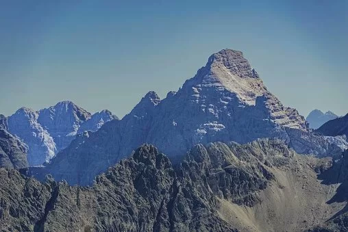
تواجه قمة جبل هوخفوجل في جبال الألب خطر انهيار صخري ضخم قد يصل حجمه إلى 400 ألف متر مكعب، بعدما رصد العلماء تسارعًا في حركة الصخور واتساع شق جيولوجي قديم إلى عدة أمتار.
ويقع الجبل، الذي يبلغ ارتفاعه 2592 مترًا، على الحدود بين ولاية بافاريا الألمانية وإقليم تيرول النمساوي، حيث يراقب باحثون من الجامعة التقنية في ميونيخ تطورات الشق الصخري منذ عام 2014، وسط مؤشرات على اقتراب انفصال كتلة ضخمة من الصخور عن منطقة القمة.
ووفقًا لتقرير نشرته شبكة «يورونيوز» في 11 أكتوبر، يتراوح الحجم المحتمل للانهيار القادم بين 250 ألفًا و400 ألف متر مكعب من الصخور والركام، فيما شهد الجبل في يونيو الماضي انهيارًا أصغر بلغ حجمه نحو ألفي متر مكعب، ويخشى العلماء أن يكون ذلك جزءًا من عملية تفكك أوسع في الكتلة الصخرية.
ويمتد الشق الرئيسي في القمة، الذي تعود الإشارات التاريخية إلى وجوده إلى القرن التاسع عشر، بعرض يصل إلى ستة أمتار وعمق يتجاوز 60 مترًا، وفقًا للقياسات المنشورة. وفي بعض أجزائه، تبدو الصخور المنفصلة وكأنها كتل متجاورة تفصل بينها فجوات متسعة، ما يزيد المخاوف من انهيار جزء من القمة إلى المنحدرات أسفلها.
وسجلت أجهزة الرصد خلال الربيع تحركات للصخور وصلت في بعض الفترات إلى خمسة مليمترات أسبوعيًا، وهي سرعة كبيرة في السياق الجيولوجي. وقال خبراء إن هذه المؤشرات تستدعي متابعة مكثفة، في ظل احتمال أن تكون عملية الانهيار الأكبر قد بدأت بالفعل، مع عدم القدرة على تحديد موعد دقيق لحدوثه.
ويعزو العلماء تطورات الشق إلى مجموعة من العوامل الطبيعية، تشمل التعرية والتغيرات الحرارية والأمطار الغزيرة، التي يمكن أن تسرّع تفتت الصخور وتؤثر في تماسك الكتل المعرضة للانفصال. كما يدرس الباحثون تأثير التغير المناخي في تسريع تحلل الصخور وزيادة مخاطر الانهيارات في المناطق الجبلية.
ولمراقبة الوضع، يستخدم الباحثون أكثر من 30 مستشعرًا لرصد حركة الصخور والتغيرات الدقيقة في الشقوق، إلى جانب أجهزة قياس الاهتزازات والمسح الليزري والتصوير ثلاثي الأبعاد. وتتيح هذه الأنظمة متابعة تحركات القمة بدقة عالية، وتوفير بيانات تساعد العلماء على تقييم تطور الخطر وتحسين أنظمة الإنذار المبكر.
وتعمل فرق البحث على تطوير نظام يسمح برصد العلامات التي قد تسبق الانهيار، بما يساعد على اتخاذ قرارات بشأن إغلاق مسارات التسلق أو تحذير المتنزهين عند الضرورة. ويُعد جبل هوخفوجل موقعًا مهمًا لاختبار هذه التقنيات، التي يمكن تطبيقها لاحقًا في مناطق جبلية أخرى تهدد الانهيارات الصخرية فيها السكان والبنية التحتية.
The summit of Mount Hohe Vogl in the Alps faces the risk of a massive rockfall that could reach a volume of 400,000 cubic meters, after scientists observed an acceleration in rock movement and the widening of an ancient geological crack by several meters.
The mountain, which stands at 2,592 meters, is located on the border between the German state of Bavaria and the Austrian region of Tyrol, where researchers from the Technical University of Munich have been monitoring the developments of the rock fissure since 2014, amid indications that a massive block of rock is close to separating from the summit area.
According to a report published by the “Euronews” network on October 11, the potential size of the upcoming collapse ranges between 250,000 and 400,000 cubic meters of rock and debris, while the mountain experienced a smaller collapse last June, with a volume of about 2,000 cubic meters, raising fears among scientists that this might be part of a broader disintegration process in the rock mass.
The main fissure at the summit, which historical records indicate has existed since the 19th century, measures up to six meters in width and exceeds 60 meters in depth, according to published measurements. In some parts of it, the separated rocks appear as adjacent blocks with widening gaps between them, increasing concerns about a portion of the summit collapsing down the slopes below.
Monitoring devices recorded rock movements during the spring that reached up to five millimeters per week at certain times, which is a significant speed in geological terms. Experts stated that these indicators warrant intensive monitoring, given the possibility that the larger collapse process may have already begun, with no ability to determine an exact time for its occurrence.
Scientists attribute the developments of the fissure to a combination of natural factors, including erosion, thermal changes, and heavy rainfall, which can accelerate rock disintegration and affect the cohesion of blocks at risk of separation. Researchers are also studying the impact of climate change on accelerating rock decay and increasing the risks of landslides in mountainous areas.
To monitor the situation, researchers are using more than 30 sensors to track rock movement and subtle changes in the fissures, along with vibration measurement devices, laser scanning, and 3D imaging. These systems allow for precise tracking of the summit’s movements and provide data that helps scientists assess the evolution of the danger and improve early warning systems.
Research teams are working on developing a system that allows for monitoring signs that may precede a collapse, which would aid in making decisions about closing climbing routes or warning hikers when necessary. Mount Hohe Vogl is an important site for testing these technologies, which can later be applied in other mountainous areas where rockfalls threaten residents and infrastructure.
للمزيد من المقالات
اضغط هنا
التعليقات